
By HistoraEDU
A student points to two nearby names on a road map and concludes that the journey between them must have been quick. The problem is not careless arithmetic. The student has treated a flat drawing as a travel record. Use one named section of the Inca Trail to separate three questions: how far a route goes, how its elevation changes and how long a particular journey took. The lesson ends with a better explanation, not an invented speed for an Inca messenger.
Begin with one named section
Open the SERNANP visitor map of the Historic Sanctuary of Machupicchu. On its map page, locate Abra Warmiwañusca, Pakaymayo Alto and Abra Runkurakay. Follow the marked route between the two passes through the intervening area. Spellings vary across English-language trail materials; keep the official map labels beside the names students use.
Ask partners to make a three-column note headed distance, elevation and time. They should record only what the source actually supplies. A line joining places establishes a route relationship; its short appearance on a page does not establish a short walk. Before measuring any map, students need an appropriate scale and a clear distinction between straight-line separation and distance along the winding route.
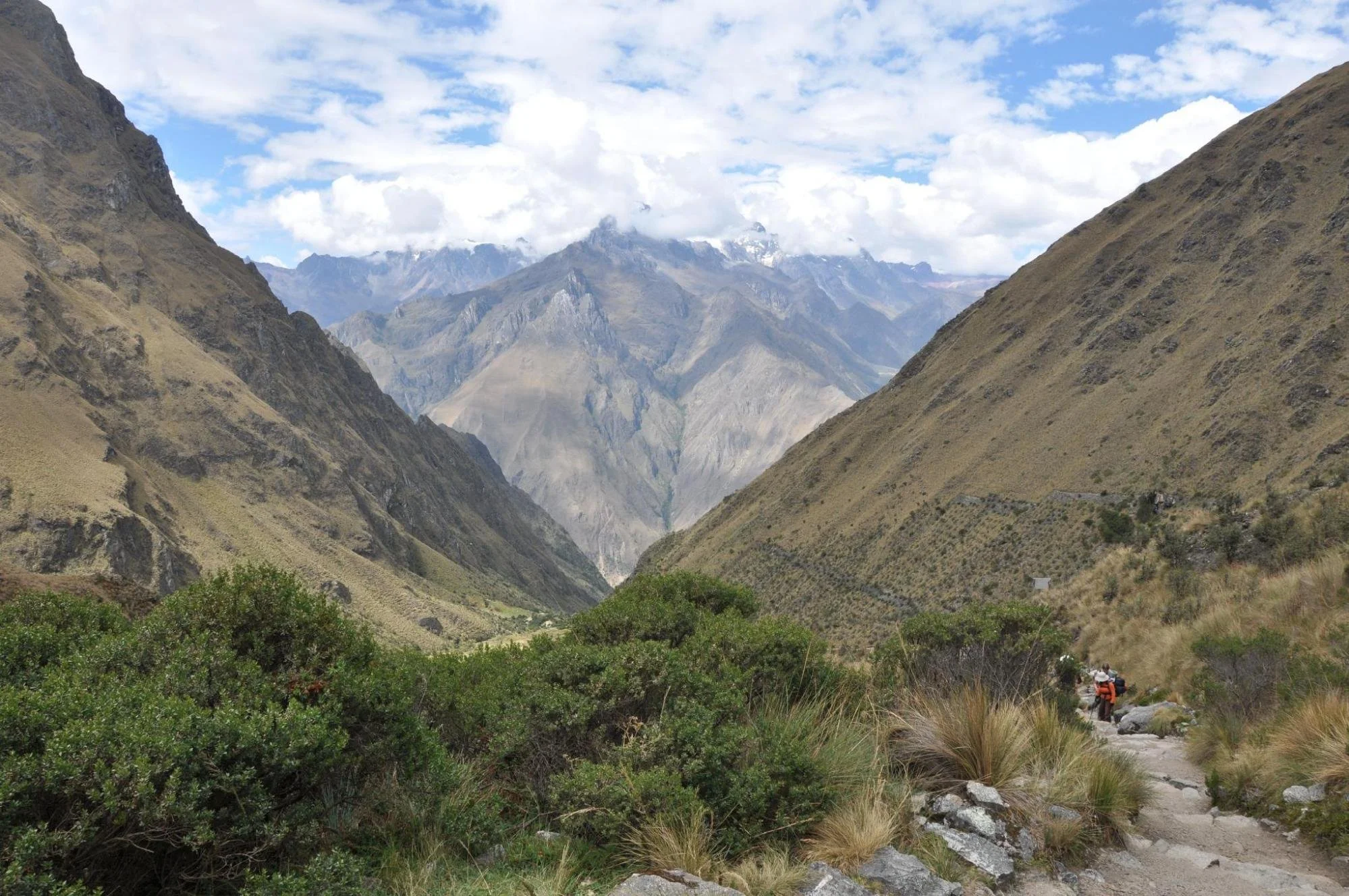
Modern landscape at Warmiwañusca pass, photographed by Dmitry Brant on May 30, 2009. The visible hikers are not historical chasqui messengers. Unaltered photograph, CC BY-SA 4.0.
Make a calculation that the map supports
The SERNANP map labels Warmiwañusca at 4,200 metres above sea level and Runkurakay at 3,970 metres. Subtracting 3,970 from 4,200 gives 230 metres. That is the difference between the two labeled endpoint elevations. It is not the length of the trail, the total descent or the total climbing required along the way.
Have students complete this sentence: “The second pass is labeled 230 metres lower than the first, but that does not tell us ___.” Accept answers about total ascent, total descent, path length or journey duration, provided the explanation names the missing information. An endpoint can be lower even when the route includes a substantial climb after a descent.
Keep the units visible. Metres above sea level describe elevation relative to a reference level. Metres traveled describe distance along a route. The same unit does not make those measurements interchangeable. If a student writes “the trail is 230 metres long,” ask which two numbers were subtracted and what those numbers measured.
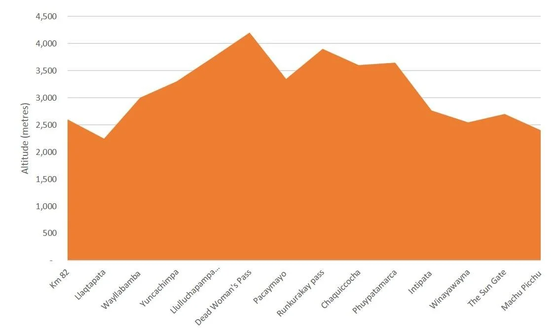
Modern illustrative Inca Trail altitude graph by Burnhamarlidge, 2015. Its horizontal axis names places rather than supplying a distance scale; it is not a historical journey log or a verified survey profile. Use it to examine the limits of a graph, not to calculate speed or adopt exact elevations. Unaltered, CC BY-SA 4.0.
Read the axes before reading the shape
Show the modern profile above after students have made their endpoint calculation from the official map. Ask what its vertical axis measures and what its horizontal labels represent. The equal spacing of place names does not demonstrate equal distances between those places. Nor does the picture provide an elapsed-time axis.
Give students a teacher-created claim to test: “The two passes occupy similar amounts of space on the graph, so their approaches take the same time.” They should reject it because the horizontal axis is categorical, not a time or distance measurement. Do not substitute approximate heights read from this illustration for the official map labels used in the 230-metre calculation.
This is a useful place to reward restraint. “We cannot calculate that from this graph” is a complete beginning to an evidence-based answer when the student explains what additional record would be needed. A route-distance measurement, a sufficiently detailed elevation profile and evidence about a particular journey would answer different parts of the question.
Put terrain back into the history
The Smithsonian National Museum of the American Indian explains that Inka road construction varied with local environments and materials. Its account describes engineered routes in mountainous terrain and structures for crossing streams. Use that context to ask why a road network cannot be understood as identical straight lines drawn across every landscape.
Keep the historical question separate from a modern tourist itinerary. A present-day hiking recommendation is not evidence of how long a particular Inca messenger took. Weather, route condition, direction, the task being performed and the person making the journey all matter to an explanation; this lesson supplies no historical travel-time record from which to calculate a runner’s speed.
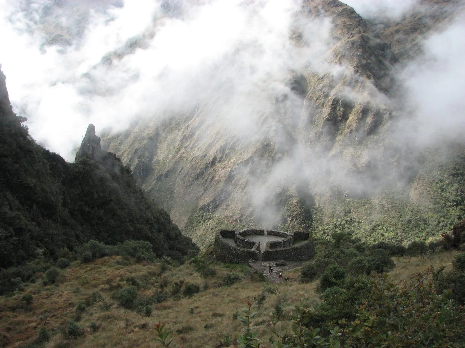
Runkuraqay archaeological site, photographed by Steve Pastor in 2008. This photograph shows the site, not a measurement at the summit of Runkurakay pass. Unaltered photograph, CC BY-SA 3.0.
Check the explanation rather than a guessed travel time
For an exit response, ask students to write three sentences. First, report the two labeled pass elevations and their 230-metre difference. Second, explain why that difference is not total climbing or path length. Third, identify evidence needed before making a claim about historical travel time.
A strong response might say: “The official map labels the passes at 4,200 and 3,970 metres above sea level, a difference of 230 metres. That compares endpoints and leaves the intervening changes in elevation unresolved. To discuss a historical journey’s duration, we would need evidence about that journey rather than a modern graph with place names.” This model is a teacher-created explanation, not a quotation from an Inca traveler.
For students who need support, prefill the two elevation labels and offer the sentence frame “This tells us ___, but not ___.” For an extension, let students compare a properly scaled route map with a profile whose horizontal axis is explicitly distance. Keep the task focused on interpreting representations rather than rewarding an unsupported numerical answer.
Choose a reading to accompany the map work
The map-and-axis routine above is a separate teacher-created activity. It does not require purchasing a resource. If you want a reading alongside it, choose the scope that matches your lesson and keep the measurement evidence in the cited sources.
Inca Roads and Communication Reading Passage and Questions
View this HistoraEDU resource on TPT
The listing describes a reading passage, comprehension and short-answer questions, vocabulary and an answer key, with an editable Google Doc format. Use selected road-and-communication material to introduce the network before the map task. Supply the official map separately, and do not turn a general statement about messengers into a measured speed for this particular mountain section.
Inca Empire Reading Comprehension Ancient Civilizations Worksheet
View this HistoraEDU resource on TPT
The listing describes a broader reading and question set covering geography, government and other aspects of the empire. Select the geographical context if students need an introduction before studying the route. Keep this lesson’s scope on terrain and representation; conquest claims are not needed to complete the activity.
Sources and image credits
SERNANP official Machupicchu visitor map and pass labels
SERNANP Historic Sanctuary of Machupicchu route information
Smithsonian NMAI how the Inka Road reflected local environments
Creative Commons Attribution ShareAlike 4.0
Creative Commons Attribution ShareAlike 3.0
Product thumbnail reproduced from the exact HistoraEDU listing at the owner’s request. Historical photographs are separate evidence, not product endorsements. The two modern landscape photographs and existing illustrative profile are reproduced without alterations under their credited licenses. The official map is linked rather than reproduced. No photographed person endorses the resources.


