
By HistoraEDU
A student traces a blue route across a Civil War map and announces, “They went around the other army, so the plan worked.” The line has quietly become a complete story: orders were understood, troops arrived together and opponents stayed put. A useful map lesson interrupts that leap. Students need to distinguish what someone intended, what a source reports and what a later representation assembles.
Start with the 1861 Bull Run map held by the U.S. Military Academy Library. Unlike a modern diagram with sweeping arrows, it uses colored troop marks, roads, streams and written notes. Keep the full-size institutional image available for enlarging its legend; the reproduction below is an orientation view, not a substitute for reading the original details.
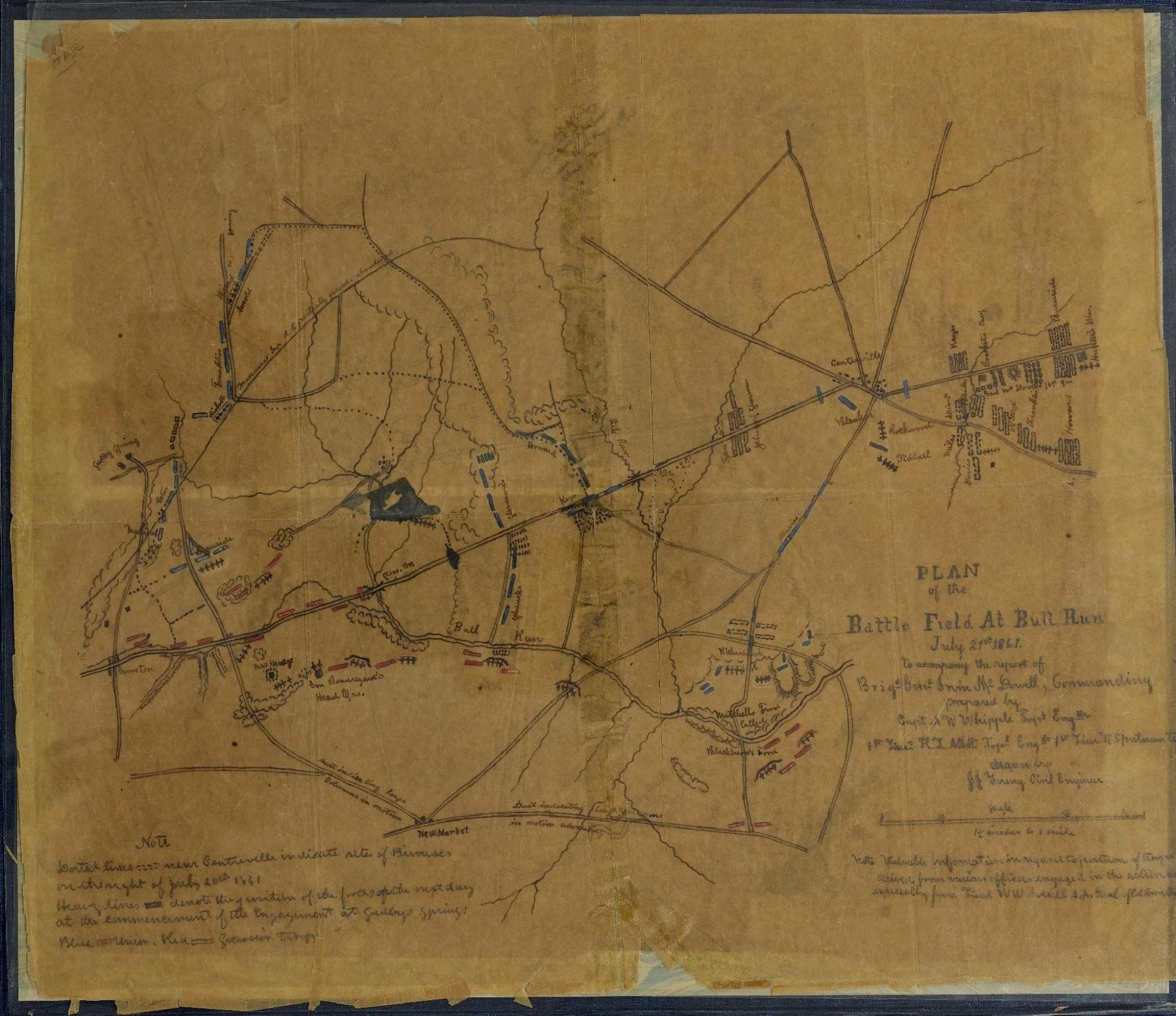
Bull Run map, 1861, prepared by Whipple and fellow engineers for McDowell’s report. This is a reproduction of a report map, not live tracking. Credit: U.S. Military Academy Library. Public domain. Open the source image to read its fine detail. Image source
Read the map as a document before following a route
Give pairs four source-card fields: creator, date, event and purpose. The library identifies Amiel Weeks Whipple and fellow engineers with this map, cataloged as 1861 and prepared to accompany Brigadier General Irvin McDowell’s report. The battle date, July 21, 1861, is not proof that the sheet was issued as an order before the battle. A report map can represent earlier intentions retrospectively.
The library’s exhibit explains the blue columns at the left as the intended main Union attack around the Confederate left. Its transcription distinguishes dotted lines showing bivouacs on July 20 from heavy marks showing positions at the beginning of the engagement. Ask students to locate the relevant note before interpreting a mark. Color identifies a force; it does not certify that every intended action happened.
Model a revision aloud. Initial claim: “The blue marks prove the Union outflanking movement succeeded.” Better claim: “The report map represents an intended outflanking movement. To judge its execution, we need evidence about timing, detection and resistance.” This is not declaring the map useless. It is choosing a question the map can help answer without making it answer every question.
Test one movement against a documented constraint
Pair the map with the National Park Service’s First Manassas account. It describes the flanking column setting off at 2:30 a.m. on July 21, with slow progress by the leading division. Around 9 a.m., Confederate signal officer E. Porter Alexander observed the approaching movement and warned Nathan Evans, who shifted much of his brigade to meet it. These reported developments complicate an effortless sweep across a diagram.
Ask, “Which information is missing from the colored marks alone?” Possible answers include the delay and the warning. Have students connect one detail to a consequence: movement that takes time can give an opponent an opportunity to detect and respond. Require the account as evidence for this particular sequence; a general claim that communications matter is not enough. Do not calculate marching speed from the thickness or length of a troop symbol.
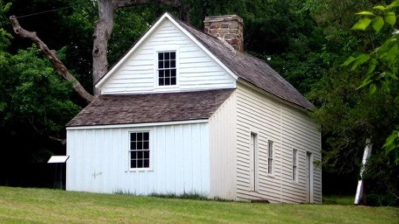
Modern photograph of the Thornberry House on the Sudley Loop, not a photograph of the 1861 battle. Credit: NPS. No claim to original U.S. Government works. Image source
The modern photograph shows the Thornberry House along the park’s Sudley Loop. Use the NPS trail description to locate nearby streams and the Sudley Spring Ford site. Then ask what the photograph cannot establish: the water depth on July 21, the marching column’s exact pace or what a soldier could see from a different position. A preserved place can prompt a geographic question without recreating a past viewpoint.
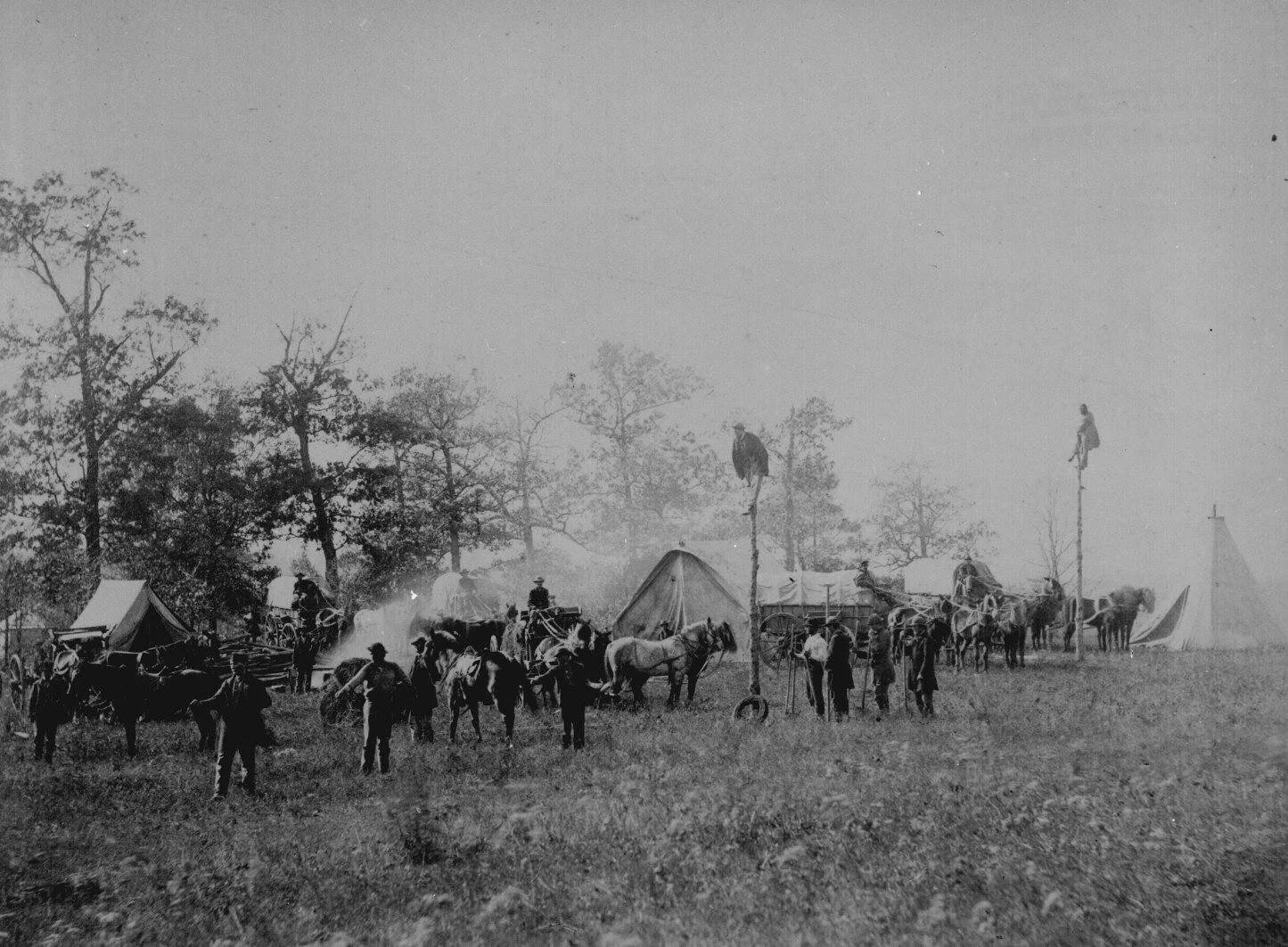
Constructing telegraph lines, April 1864, photographed by Timothy H. O’Sullivan. This later scene is not Alexander’s signal at First Manassas. Credit: National Archives, NAID 533336, 165-SB-62. Public domain. Image source
This 1864 photograph makes the work behind communication visible: people, poles, animals, vehicles and equipment. It does not show Alexander’s 1861 signal or establish that this telegraph line served Bull Run. Ask students why a message route on a map is not the same thing as a functioning communication system. Keep that comparison separate from the verified battle sequence.
Turn the reading into a short evidence task
In a twenty-minute routine, spend five minutes identifying the map and decoding two marks. Allow seven minutes to compare one map feature with the NPS account. Give pairs five minutes to write three labeled statements: intended movement; reported development; question still unanswered. Use the final three minutes for partners to underline the source supporting each statement and challenge any word that implies certainty beyond it.
For support, provide enlarged legend details and the source-card fields, then read the relevant account paragraph aloud. For extension, ask students to compare this report map with a later reconstruction and identify what each compiler selected. Never treat a printed scale statement as a ruler calibration after an image has been resized.
Use an exit ticket with this stem: “The map helps me explain ___, but I also need ___ because ___.” A successful answer names a specific mark and a specific information gap, not simply “maps can be biased.”
Choose background reading to serve the map question
These HistoraEDU resources are non-editable PDF readings, not interactive maps. Their listed questions and teacher materials can provide background before students return to the institutional sources. Choose the relevant reading rather than assigning every worksheet as additional evidence for the same claim.
Battle of Bull Run: The Shocking First Battle of the Civil War
Use the Bull Run reading to establish the event before the map investigation. Ask students to distinguish a statement from the reading from something the map itself shows; neither source should silently stand in for the other.
Union vs Confederate Strategies: Who Had the Better Plan?
Use the strategies reading to distinguish an overall plan from its execution at one battle. The follow-up question is what evidence would show an intended movement actually happened, not which colored line looks more convincing.
Why Did Everyone Think the Civil War Would Be Short?
Use the short-war expectations reading to ask whose expectations are being described. Treat “everyone” in the product title as a question to investigate, not a literal claim about all people in 1861.
North vs South: Who Really Had the Advantage? | Civil War Reading Worksheet
Select the advantages reading when students need background on resources and limits. Return to the map to explain why an advantage does not establish the timing or success of a particular movement.
Civil War | North and South Comparison Reading Comprehension Worksheet
This North and South comparison is an alternative background reading on antebellum regional differences, with vocabulary and a cause-and-effect organizer listed. Do not automatically assign it alongside the advantages reading as two separate sets of new content.
View this HistoraEDU resource on TPT
Sources and credits
USMA Library catalog and full map image
USMA Library interpretation of the Whipple map
NPS Sudley Loop and Thornberry House
National Archives Civil War photographs and rights statement
Product covers: HistoraEDU, reproduced from the exact linked TPT listings at the owner’s request. Photographs and archival reproductions are credited beside each image. No claim to original U.S. Government works. Source institutions and depicted people do not endorse HistoraEDU or its products.
