
By HistoraEDU
A student points to a reservation boundary and says, “That is where the Nez Perce have always lived.” The map may be accurate; the inference is not. Before asking students to memorize another outline, teach them to identify what a boundary represents, when it was established and what it leaves out. A short two-map caption can reveal whether they understand those differences.
Start with a homeland account rather than an outline
Read the Nez Perce Tribe’s public history first. It describes Nimiipuu homelands across parts of present-day Idaho, Oregon and Washington, with fishing, hunting and trading movement extending into Montana and Wyoming. Students should mark those modern state names as reference points, not imagine that today’s state lines organized the earlier homeland.
Ask pairs to make three notes: places named; activities connecting places; questions the account does not answer. Do not have them draw a precise homeland polygon from a short paragraph. A list of states cannot establish a surveyed boundary or every community’s range at every date.
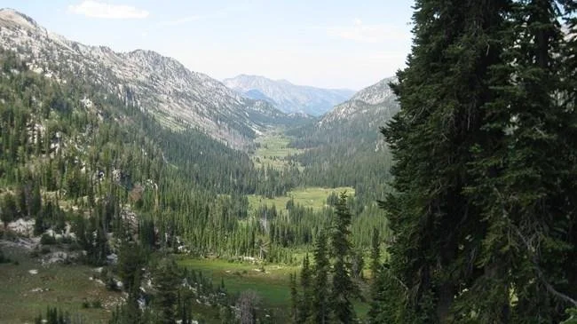
Modern view of the Wallowa Mountains, Oregon. NPS Photo, public domain; date not specified. The landscape helps locate one part of the discussion, but its appearance does not establish land ownership or a reservation boundary. Image source
The Wallowa Mountains photograph gives students a particular landscape within the wider discussion. Ask what is visible, then what is not: there is no reservation line painted across the valley. Neither vegetation nor an apparently open landscape establishes who owns land, who governs it or who may enter it.
Compare two maps with different purposes
Use the NPS Treaty Period map below beside “Historical Boundaries of the Nez Perce Reservation” in the Tribe’s 2025 Hazard Mitigation Plan, printed page 146, PDF page 154. Open the linked tribal plan for the second map; its artwork is not reproduced here. First record the creator, publication context, legend and dates represented on each.
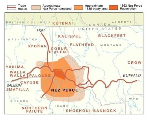
NPS interpretive map of approximate Nez Perce homeland, treaty areas and trade routes. NPS credit, public domain; webpage updated December 29, 2022, map creation date not given. The years in the key describe historical boundaries, not the map’s publication date. Image source
On the NPS map, students distinguish approximate homeland, approximate 1855 treaty area, the 1863 reservation and trade routes. On the tribal plan map, they find the 1855 boundary, the 1863 reservation labeled current, and Indian Claims Commission territory. Those are not interchangeable labels. In particular, do not rename the Claims Commission territory “the complete homeland” or treat an approximate teaching map as a parcel survey.
Have students trace with a finger rather than calculate acreage from these illustrations. The key question is “Which category changed?” The NPS treaty account explains that gold discoveries and settler encroachment preceded the 1863 reduction; bands outside the proposed boundary refused to endorse it. This was a contested political process, not the natural shrinking of a culture because people needed less space.
Model a caption that separates land and jurisdiction
Try this two-map caption: “The NPS map distinguishes approximate Nez Perce homeland and trade connections from treaty boundaries dated 1855 and 1863. The Tribe’s 2025 plan labels the smaller 1863 reservation as current and separately identifies Claims Commission territory. Neither map alone shows every landowner, every place of community connection or the full reach of treaty rights.”
Then explain why the last sentence matters. The Tribe’s history describes a checkerboard of allotments and non-Indian parcels and retained off-reservation rights. A reservation outline is therefore not a map of exclusively tribal ownership, nor does the line mean all rights and relationships stop there. This is a historical map-reading distinction, not a legal determination about a particular parcel or proposed activity.
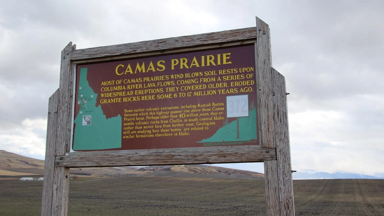
Modern interpretive sign and fields at Camas Prairie, Idaho. NPS Photo, public domain; date not specified. The linked place history, not the photograph alone, explains allotment and changes in ownership. Image source
At Camas Prairie, use the NPS account of allotment to test a new misconception: “Everything inside the outline belongs to the same owner.” The modern sign and fields do not settle that question. Students must consult the dated land history rather than infer ownership from the photograph. Keep the discussion about documented dispossession and institutions, not a classroom game in which children bargain away another people’s land.
Transfer the question without transferring the answer
For a second named case, use the Shoshone-Bannock Tribes’ own account of Fort Hall. It distinguishes broad ancestral lands from a reservation associated with the 1868 Fort Bridger Treaty and subsequent reductions. Ask students to identify the same categories—homeland, reservation, date and change—while leaving the Nez Perce dates and boundary shapes behind.
Name the Shoshone-Bannock Tribes of Fort Hall throughout. This case cannot stand for every Western, Northern or Eastern Shoshone community. A shared word in an English-language label does not make different communities’ treaties, governments or histories identical.
Modern entrance sign at the Nez Perce National Historical Park visitor center, Spalding, Idaho. NPS Photo, public domain; date not specified. A park site is not the full tribal homeland or a reservation boundary. The incidental NPS emblem is not an endorsement. Image source
Finally, show the Spalding park sign. “National historical park” identifies yet another kind of place. Ask why a park site, a tribal homeland and a reservation need separate map keys. The sign locates a public interpretive institution; it does not make that institution the government or full geographic extent of the Nez Perce Tribe.
Assess the caption and its limits
Give students an unlabeled sentence: “This map shows their land.” Require a revision naming the map’s category, represented date and one limitation. For support, offer a word bank with homeland, reservation, ownership and route. For extension, ask which additional source could answer an ownership question without pretending that the two teaching maps already do.
Choose background reading for the question
These four separate listings describe editable Google Docs with readings, comprehension questions, vocabulary and answer keys. The map routine is an added teaching suggestion, not an included product feature. Use the selected sections and qualifications below rather than treating any regional overview as a substitute for the tribal sources.
Plateau Native Americans Reading Comprehension Worksheet
Use selected geography passages to locate the Plateau before the map comparison. The unfinished Earth ovens glossary entry is not part of this lesson; do not assign it as a complete definition. Use the tribal and NPS sources for the dated treaty claims.
Great Basin Native Americans Reading Comprehension Worksheet
Use selected geography passages to introduce the Great Basin comparison. Do not assign the incomplete Pinyon pine nut entry. Qualify the reading’s language grouping: the Washoe Tribe identifies Washoe as a linguistic isolate, not a Numic language. Regional proximity does not erase distinct peoples.
Nez Perce People Reading Comprehension | Native American History
Use the homeland and historical-change topics as background for the Nez Perce case. Have students check the specific boundary claims against the Tribe’s history and maps. Horse-breeding and language-classification passages are outside this exercise.
Shoshone People Reading Comprehension | Native American History
Use the reading’s distinctions among Shoshone communities to prepare the Fort Hall transfer question. The Shoshone-Bannock source establishes this particular example; do not apply its reservation history to every community in the reading.
View this HistoraEDU resource on TPT
Sources and credits
Nez Perce Tribe: homeland, treaties and land ownership
NPS: treaty period and interpretive boundary map
Nez Perce Tribe: 2025 plan, map on printed p. 146 / PDF p. 154
NPS: Camas Prairie and allotment
Shoshone-Bannock Tribes: Fort Hall and ancestral lands
Washoe Tribe: strategic plan, language distinction, PDF p. 4
Product covers: HistoraEDU, reproduced from the exact linked TPT listings at the owner’s request. Photographs and archival reproductions are credited beside each image. No claim to original U.S. Government works. Source institutions and depicted people do not endorse HistoraEDU or its products.
