
HistoraEDU | Teach the legend before the colored regions
A student points to a colored region and says that a Native nation could not have traveled beyond its edge. The student has read a classroom category as a border. Instead of replacing one map with another set of labels, make the map’s purpose part of the lesson. Use one named community and a documented route to show what a broad regional grouping helps organize—and what it cannot establish.
Ask what the line actually means
Begin with the cultural-region map already used in your course, not an uncredited map copied from an image search. Read its title, maker, date and legend. Does it show broad cultural groupings, a particular nation’s homeland, a reservation, a treaty area or a modern state boundary? Those are different kinds of information. If the map does not explain the period or basis for its regional divisions, record that limitation before students use it as evidence.
Make two columns: “The map groups” and “The map does not establish.” In the first, students can name the categories actually present in the legend. In the second, they should put claims about every person’s language, government, travel or political rights unless the map and supporting sources specifically address them. A region label is not a substitute for a nation’s name.
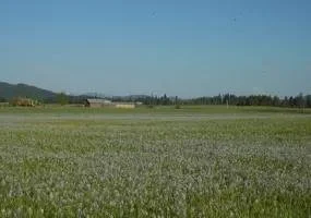
Camas blooming at Weippe Prairie. Nez Perce National Historical Park photograph, public-domain U.S. Government work; photograph date not stated on the source page. This modern landscape is not a photograph of an 1805 encounter or an earlier harvest.
Use a route that complicates the colored box
For a focused example, investigate the nimíipuu, also known as the Nez Perce, and the Lolo Trail. The National Park Service describes a route from Weippe Prairie over the Bitterroot Mountains into western Montana and the northern Great Plains. It provided access to food-gathering and hunting areas, including bison country, and supported trade. That account challenges the idea that a regional boundary on an educational map contained all a community’s movements and relationships.
Locate Weippe Prairie, the Bitterroot Mountains and western Montana on a teacher-provided reference map. If your cultural-region map shows Plateau and Plains labels, compare the route with that particular division. Do not invent an exact boundary crossing where the classroom map is too generalized to support it. The useful finding is that the regional label does not fully describe the documented connection.
Add a date to the discussion rather than presenting the route as a timeless line. The same NPS account documents non-treaty nimíipuu bands using the trail during their flight in July 1877. Label that episode separately from earlier travel for food and trade. A movement under military pressure is not interchangeable with a seasonal journey, even when parts of the route overlap.
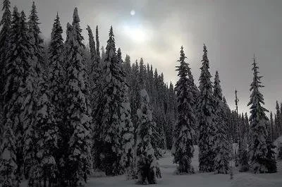
Modern view of the Lolo Trail and Pass area. USDA Forest Service photograph by Roger Peterson, credited on the National Park Service page. Public-domain U.S. Government work; photograph date not stated. Snow in this view does not establish conditions during a particular historical journey.
Separate a place name from a political boundary
Now bring in the Camas Prairie marker. The NPS place account describes seasonal use of the prairie and its relationship to the Nez Perce Reservation. A prairie, a cultural region and a reservation are not three names for the same kind of area. Ask students which term describes a landscape, which is a broad analytical grouping, and which concerns a political and legal geography.
Do not use this exercise to draw or assert current legal boundaries. If your next lesson concerns a treaty or a reservation boundary, use the specific dated document and a source from the relevant Native nation. A colored cultural-region map cannot settle land ownership, jurisdiction or treaty rights.
The sign photograph is useful precisely because it is a modern act of interpretation. Ask who created the marker, what it emphasizes and which questions need another source. Its presence does not freeze the surrounding landscape or community in the nineteenth century.
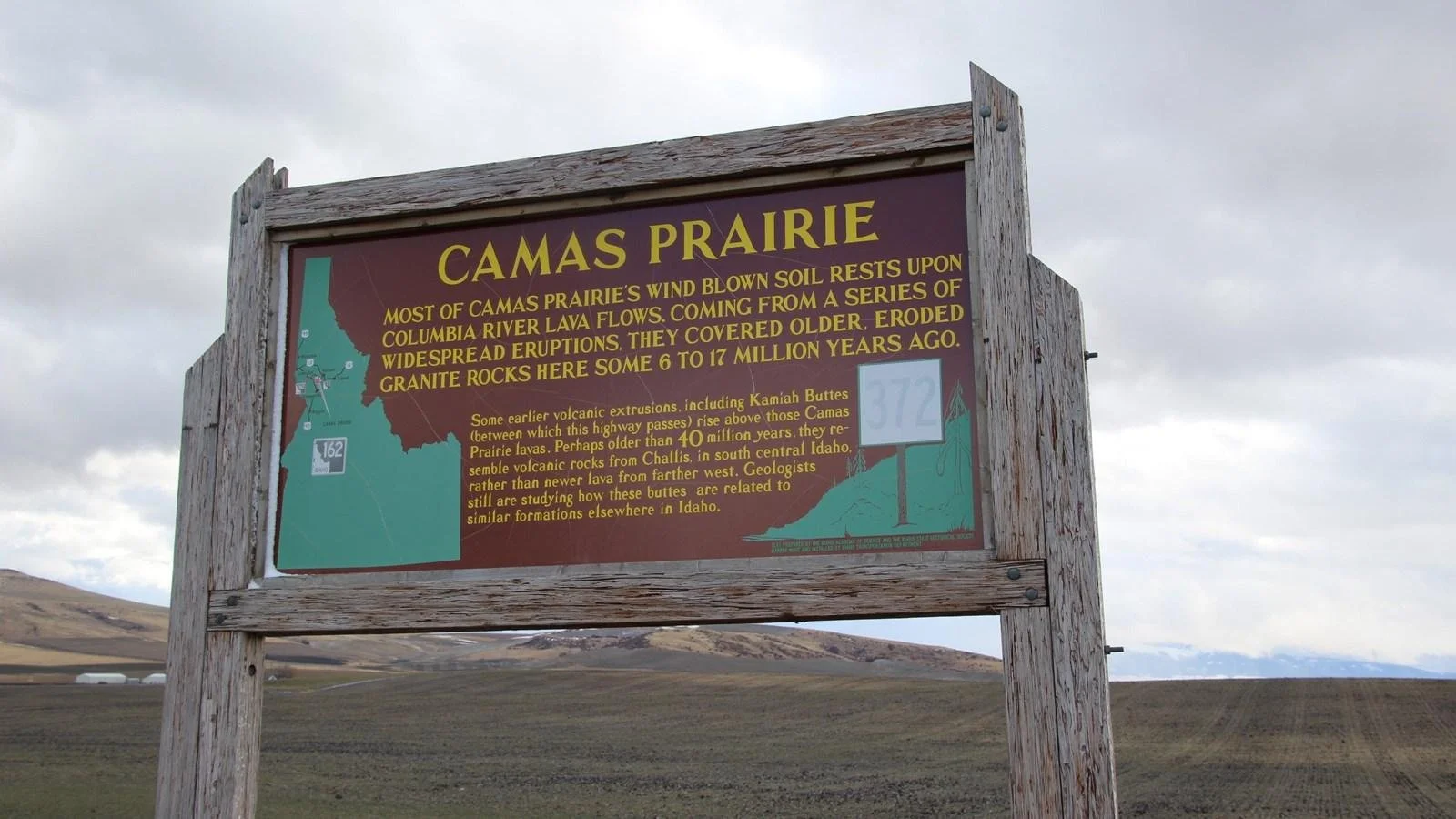
Modern Camas Prairie interpretive sign and surrounding field, Nez Perce National Historical Park. NPS Photo, public domain. The sign is a present-day interpretation of a place with a longer history; it is not a photograph of an earlier harvest.
Repair the legend and the student claim
Give students this invented claim: “The Nez Perce belonged to one region, so crossing the line meant entering a different culture.” Ask them to revise it using the named route and the map’s actual purpose. A stronger response might say: “This map groups broad regional patterns. The documented Lolo Trail connections show why that grouping does not contain all nimíipuu travel or relationships.”
Then have partners propose a clearer legend note for the classroom map: “Broad cultural groupings for comparison, not fixed national borders or a complete account of any people.” Require them to add the map’s own date or explain that its historical period is unspecified. This is an annotation beside the teaching copy, not permission to change a copyrighted map or remove its original legend.
Check a second overcorrection: “Because the lines are simplified, the map is useless.” Students should explain one question the map can help organize and one it cannot answer. The goal is appropriate use, not suspicion of every visual source.
Keep living nations in the lesson
The Smithsonian’s Native Knowledge 360 framework emphasizes cultural diversity, change, Native perspectives and the continuing presence of Native peoples. Apply that principle to your source choices. When extending the example, consult public material from the specific nation rather than turning a regional label into its voice. Do not ask a student to authenticate a map on behalf of a community.
For an exit response, require a map feature, a named historical example and a limit. “The map has colored regions” is an observation. “The Lolo Trail connected named places used by nimíipuu people” is a sourced example. “The region line is not a complete account of travel or political boundaries” explains the limit. Together, these show more understanding than memorizing which color belongs to which region.
Use readings and review for different purposes
The two readings below can supply vocabulary for geography and cultural grouping. The Lolo Trail investigation and legend-repair routine are teacher-added examples, not promised sections of the downloads. Choose a short passage that serves the map question rather than assigning two readings as if they were interchangeable.
The digital game is a different format. A recall question can follow the inquiry, but a correct game response alone does not show that students understand a map’s limitations. Preview its questions and test its gameplay in your teaching environment before using it with a class.
Geography and Native American Life Reading Comprehension Worksheet
View this HistoraEDU resource on TPT
The listed editable Google Doc addresses geography, resources and environmental relationships. Use selected vocabulary to distinguish a landscape from a regional label; preview the passage rather than treating broad descriptions as rules for every nation.
Native American Cultural Regions Reading Passage and Questions
View this HistoraEDU resource on TPT
The listed editable reading introduces cultural regions, regional diversity and historical change. It can support the map-category discussion. Add the dated route evidence and legend qualifications above rather than assuming a region name explains a whole community.
Indigenous America Review Game | Native American Societies Quiz | Test Prep
View this HistoraEDU resource on TPT
The listing describes a digital review game with 60 questions, teacher instructions, an editable template and a student gameplay link. It is not a reading worksheet. Preview the selected questions and verify the actual game before classroom use; this article does not claim tested runtime, answer accuracy or accessibility.
Sources and image credits
Native Knowledge 360 essential understandings
Lolo Trail history and the separate July 1877 episode
National Park Service image reuse notice
Product thumbnail reproduced from the exact HistoraEDU listing at the owner’s request. Historical photographs are separate evidence, not product endorsements. No claim to original U.S. Government works. Agency photographs identify places and do not imply endorsement.
